Benefits of Using Total Lightning for Safety Alerts
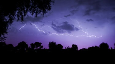

Timely lightning alerts are essential to keep people safe when severe weather threatens. But not all lightning is the same. Although cloud-to-ground (CG) flashes tend to be the deadliest and cause more damage, total lightning is the better predictor of severe weather.
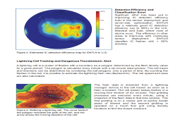
Many studies have shown the detection of both intracloud (IC) and cloud-to-ground flashes, or total lightning, improves the lead times of severe weather prediction. Severe thunderstorms, which can generate lightning, high wind, hail, and tornadoes have certain characteristics in the lightning flashes, such as an abrupt increase in IC flash rates, during the storm formation stage.
As a result, alerting on total lightning is required to get ahead of the storm and deliver the warning lead times needed to clear outdoor areas and keep people safe when dangerous storms approach a location.
Check out the research below to learn more about the importance of using total lightning for safety alerts.