Thunderstorms: Everything You Need to Know
Thunderstorms: From science to safety, we’ve got you covered.
Whether you enjoy stormy weather or not, thunderstorms happen anyway.
But how much do you really know about thunderstorms?
On this page, we’ll go through everything you need to know about thunderstorms and then some!
You can read through this entire guide to become a thunderstorm expert, or jump to the section you’re most interested in using the buttons below.
Don’t forget to share this page with anyone who might be interested!
The ultimate guide to #thunderstorms (30 min. read) Share on XDon’t Have Time to Read the Entire Guide Now?
Download a PDF version of the guide you can reference later.
👇 Keep Scrolling to Start Reading!👇
Thunderstorm Facts

First of all, let’s answer the most common thunderstorm question we get: What is a thunderstorm?
At the most basic level of explanation, a thunderstorm is a rain shower where you can hear thunder. Easy enough, right?
But what is thunder? When lightning flashes across the sky it makes a noise. That noise is – you guessed it – thunder!
So when people ask: “Can you have thunder without lightning?” The answer is no.
You may hear thunder without seeing lightning, but that might be because you’re too far away from the storm or you simply missed the strike. Here’s a more technical definition of thunderstorm.
Thunderstorm: Also known as an electrical storm or lightning storm, a thunderstorm is characterized by the presence of lightning and its acoustic effect on the Earth’s atmosphere, known as thunder.
Thunderstorms can happen all over the world, but in the United States they are most likely to occur in the spring and summer months during afternoon and evening hours.
Thunderstorm Types
![]()
![]() When we talk about thunderstorm facts, we don’t stop at the basics. Did you know there are actually a few different types of thunderstorms? We’ll go over them in this section.
When we talk about thunderstorm facts, we don’t stop at the basics. Did you know there are actually a few different types of thunderstorms? We’ll go over them in this section.
A severe thunderstorm is a thunderstorm that includes a tornado, drops hail of one inch or greater, and/or has wind gusts in excess of 57.5 mph.
This is probably the most common thunderstorm type you may hear about on the news or in the weather forecast, but our friends at the National Severe Storms Laboratory (NSSL) cover a few more details that we’d like to share with you.
Single-Cell vs. Multi-Cell
Did you know that there are both single-and multi-cell thunderstorms?
A single-cell thunderstorm is also known as a “popcorn” convection. These storms are small, brief, and weak. They tend to grow and die within an hour. You’ll typically see these storms on a hot summer afternoon.
Don’t be fooled by their weak description. Single-cell thunderstorms can produce brief heavy rain and lightning.
On the other hand, multi-cell thunderstorms can be a bit more severe. As your typical thunderstorm, multi-cell storms can produce new cells and therefore last as a system for hours. They also can produce hail, strong winds, brief tornadoes, and flooding.
Squalls and Supercells
When a multi-cell storm grows in a line that’s 10 to 20 miles wide we call that a squall line. This group of storms is often accompanied with high wind and heavy rain. While squall lines can be intense, they tend to pass quickly.
Supercells, on the other hand, are long-lived. In fact, they occur for at least one hour. These highly organized storms feed off an updraft that is tilted and rotation. This updraft can be up to 10 miles in diameter and up to 50,000 feet tall!
You may see the updraft as much as 20 to 60 minutes before a tornado forms. Supercells are where the most violent tornadoes come from.
![]()
![]() Speaking of tornadoes, the next type of storm we’ll cover is a “bow echo.” We see bow echoes on radar and they help us predict tornadoes. It’s basically a squall line that “bows out” as winds fall behind the line and start to circulate.
Speaking of tornadoes, the next type of storm we’ll cover is a “bow echo.” We see bow echoes on radar and they help us predict tornadoes. It’s basically a squall line that “bows out” as winds fall behind the line and start to circulate.
A strongly bowed echo may indicate high winds in the middle of the line, where the storms are moving forward most quickly. Brief tornadoes are likely to occur on the leading edge of a bow echo.
Mesoscale Convective Systems
The next type of thunderstorm grouping is a Mesoscale Convective System (MCS). This is a collection of thunderstorms that can spread across an entire state and last more than 12 hours.
We use this term to classify any of the following storm types:
![]()
![]() Mesoscale Convective Complex (MCC): Large, circular, long-lived cluster of showers and thunderstorms
Mesoscale Convective Complex (MCC): Large, circular, long-lived cluster of showers and thunderstorms
![]()
![]() Mesoscale Convective Vortex (MCV): A low-pressure center that pulls winds into a vortex
Mesoscale Convective Vortex (MCV): A low-pressure center that pulls winds into a vortex
![]()
![]() Derecho (“deh-REY-cho”): Widespread, long-lived wind storm associated with a band of rapidly moving showers
Derecho (“deh-REY-cho”): Widespread, long-lived wind storm associated with a band of rapidly moving showers
Thunderstorm Science
 Now that you know some basic thunderstorm facts and storm types, it is time we dive into the more meteorological explanations behind thunderstorms. If you don’t care about the science behind thunderstorms, feel free to skip to another section; However, we think this section is super interesting!
The most basic thing you need to know about thunderstorms is that they have three main ingredients:
![]()
![]() Moisture
Moisture
![]()
![]() Rising, unstable air
Rising, unstable air
![]()
![]() Lifting mechanism
Lifting mechanism
Thunderstorm Development
All thunderstorms go through stages of growth, development, electrification, and dissipation. Thunderstorms often develop early in the day when the sun heats the air near the ground. Then pockets of warmer air rise in the atmosphere. When these pockets of air reach a certain level, cumulus clouds form.

As things continue to heat up, the clouds grow higher into the atmosphere until they become anvil-shaped. When the cloud grows, precipitation forms within the cloud in the form of ice, hail, and rain. As these particles bump into one another they become electrically charged.
The lighter “ice crystals” become positively charged and are carried upward by rising air. The heavier “hail” becomes negatively charged, and either stays suspended by the rising air or falls towards the bottom of the storm cloud. A small positive charge also forms near the bottom on the storm cloud. Then lightning forms.
Lightning is the spark of electricity in the atmosphere or between the atmosphere and the ground. Air acts as an insulator between the positive and negative charges in the cloud and between the cloud and the ground. When the differences in charges becomes too great, the air can no longer insulate the charges. Then there is a rapid discharge of electricity we call lightning.
Effects of Thunderstorms
Now that we scientifically know what happens during a thunderstorm, it’s time to think about how it impacts our lives. What are the effects of a thunderstorm?
There are quite a few conditions that typically accompany thunderstorms. In this section, we’ll cover the following conditions and their effects on people, infrastructure, and society at large:
![]()
![]() Hail
Hail
![]()
![]() Rain & Flooding
Rain & Flooding
![]()
![]() Wind
Wind
![]()
![]() Snow
Snow
Let’s explore each of these in more detail.
Lightning
We’ve already talked about lightning and its importance in the development of a thunderstorm, but we’ll focus on the damage it can cause in this section.
Lightning is the occurrence of a natural electrical discharge of very short duration and high voltage between a cloud and the ground or within a cloud. This violent and sudden electrostatic discharge is accompanied by a bright flash and typically also thunder.
As we explained before, you can’t have a thunderstorm without lightning because thunder is the sound that lightning makes.

There are two types of lightning strikes: in-cloud and cloud-to-ground strikes. We call the combination of these types “total lightning.” In-cloud lightning strikes don’t pose a direct threat to you if you are outside during a thunderstorm but they are a great warning sign when it comes to thunderstorms in general.
Cloud-to-ground lightning strikes, on the other hand, do pose a direct threat to people, animals, and equipment outdoors. Lightning is most dangerous right before a thunderstorm arrives and right after it begins to depart. This is because we don’t see it as a threat beforehand and afterwards we think the threat is over too soon.
Cloud-to-ground lightning strikes can (and do) kill people and animals on the ground. On average, lightning kills about 30 people per year in the United States. It also causes hundreds of injuries.
This threat is far more severe in other parts of the world where lightning detection, outdoor alerting, and severe weather alerts from a national weather agency may not be as commonplace. In India, for example, more than 2,000 people have died every year since 2005 due to lightning strikes. This is due to a large number of outdoor workers, a lot of lightning activity during the monsoon season, and a lack of alerting systems to keep people safe from lightning.
If you do survive a lightning strike, you can suffer a variety of short-term side effects including third-degree burns, Lichtenberg figures, cardiac arrest, ruptured eardrums, and hearing loss. Long-term side effects including vision loss, personality changes, slower reaction times, chronic pain, ringing in your ears, and depression.
Lightning can also cause power outages and start fires. It’s one of the most dangerous weather conditions that accompanies thunderstorms.
Hail
![]()
![]() Another common thunderstorm weather condition is hail.
Another common thunderstorm weather condition is hail.
Hail is a form of precipitation that occurs when updrafts in thunderstorms carry raindrops upward into extremely cold areas of the atmosphere where they freeze into balls of ice.
Hail forms when supercooled water drops collide in clouds. Supercooled water will freeze on contact with ice crystals, frozen raindrops, dust, or some other nuclei.
Thunderstorms that have a strong updraft keep lifting hailstones up to the top of the cloud where they encounter more supercooled water and continue to grow. Hail then falls out of the sky when the thunderstorms’ updraft can no longer support its weight.
Hail falls differently depending on what’s going on with the thunderstorm. If winds are strong enough, hail can even fall at an angle. Hail size ranges widely from pea-sized to even grapefruit-sized! The largest hail recovered in the U.S. had a diameter of 8 inches, a circumference of 19.62 inches, and weighed 1 lb 15 oz.
Only the very largest hail stones pose serious risk to people caught in the open, but smaller hailstones can still damage property. Hail is just another reason why you should head indoors if a thunderstorm is on its way!
Rain & Flooding
![]()
![]() Another condition that typically accompanies a thunderstorm is rain. While this seems obvious, rain is actually one of the most dangerous aspects of a thunderstorm. Why? Because rain can cause flooding.
Another condition that typically accompanies a thunderstorm is rain. While this seems obvious, rain is actually one of the most dangerous aspects of a thunderstorm. Why? Because rain can cause flooding.
Flash flooding from thunderstorms in the number one severe weather killer in the U.S. It kills more people each year than hurricanes, tornadoes, or lightning.
Flash Floods: The most dangerous kind of floods, which occur when excessive water fills normally dry creeks or river beds along with currently flowing creeks and rivers, causing rapid rises of water in a short amount of time.
Flash floods can happen with little to no warning. They can also happen in every U.S. state.
Densely populated areas, low spots, areas near rivers, and areas near dams are most at risk for flash flooding. Flood water can easily sweep you and your car away which is why we say, “Turn around, don’t drown.”
Wind
![]()
![]() Another common thunderstorm condition is wind. When we talk about wind in this section, we’re specifically talking about straight-line winds rather than tornadoes.
Another common thunderstorm condition is wind. When we talk about wind in this section, we’re specifically talking about straight-line winds rather than tornadoes.
Strong thunderstorm winds can come from a number of different processes, but most thunderstorm winds that cause damage on the ground are a result of outflow generated by a downdraft. Damaging winds are classified as those exceeding 50-60 mph.
We have specific names for winds that come from thunderstorms.
Downbursts: Common cause of wind damage from a thunderstorm that can reach over 100 mph. These are caused by air being dragged down by precipitation. When the air reaches the ground, it spreads outward across the surface of the land it encounters in a straight line.
Another type is a derecho, which is a fancy name for a wind storm.
Winds from thunderstorms can blow debris around, uproot trees, and even flip over mobile homes and vehicles.
Tornadoes
![]()
![]() One of the scariest effects of thunderstorms is a tornado. A tornado is a rapidly rotating column of air extending down from a thunderstorm to the surface of the Earth. This mobile, funnel-shaped cloud typically advances beneath a large storm system.
One of the scariest effects of thunderstorms is a tornado. A tornado is a rapidly rotating column of air extending down from a thunderstorm to the surface of the Earth. This mobile, funnel-shaped cloud typically advances beneath a large storm system.
Tornadoes form when the right combination of winds meet in a thunderstorm. This can happen anywhere, but tornadoes are most likely to happen in the U.S. in Tornado Alley. Tornado Alley is a nickname given to the Great Plains where tornadoes often occur. Tornadoes frequently form in this area thanks to the combination of moist, warm air from the Gulf of Mexico and cool, dry air from Canada.
Tornadoes can spin at speeds over 200 mph and cause catastrophic damage in their wake. Tornadoes can pick up cars, blow out windows and doors, and completely flatten neighborhoods.
If you live in an area that is prone to tornadoes, it’s imperative that you are prepared with the right information. Make sure you have a safe shelter to wait out the storm that complies with FEMA criteria or ICC 500 standards. If you don’t have a shelter matching that description, move to a basement or a small, interior, windowless room on the lowest level of a building when a tornado is nearby.
Snow
![]()
![]() Have you ever heard of thundersnow? This isn’t a made up weather condition. It’s a real, meteorological term.
Have you ever heard of thundersnow? This isn’t a made up weather condition. It’s a real, meteorological term.
Thundersnow is a term we use to describe a thunderstorm when snow falls instead of rain. These typically happen during the winter months and are far less common than their summer counterparts.
There are typically three causes of snow during a thunderstorm. The first is a normal thunderstorm on the leading edge of a cold front or warm front. These have to form in a winter environment or run into cool air.
The second reason it may snow during a thunderstorm is when a heavy synoptic snowstorm sustains strong vertical mixing. An upward motion allows for favorable conditions for lightning and thunder to occur because warm air is trying to get through the much cooler air.
The last reason why thundersnow forms is due to lake effect or ocean effect thunderstorms. Cold air passing over relatively warm water will create these types of storms. The effect commonly produces snow squalls over the Great Lakes along with the thundersnow.
When a thunderstorm includes snow, lightning seems brighter as it reflects off the snow. On the other hand, the sound of thunder is softer as the snow dampens the snow. You’ll only hear thunder from this type of thunderstorm from 2 to 3 miles away.
Unfortunately, these storms can be very dangerous because they often are part of very strong winter storms. Oftentimes, thundersnow produces heavy snowfall rates in the range of 2 to 4 inches per hour. This type of snowfall intensity limits visibility, can have tropical storm force winds, freezing temperatures, and ice accumulation.
Thunderstorm Safety

How should you stay safe during a thunderstorm? As long as you know a storm is coming, it should be relatively easy to stay safe. When storms sneak up on people is when most tragedies occur. Keep reading this section to learn what to do before, during, and after a thunderstorm to stay safe!
Before
![]()
![]() There is a lot you can do to prepare for a thunderstorm. Preparation is the key to safety during any severe weather event. Here are some tips for keeping thunderstorms from catching you off guard.
There is a lot you can do to prepare for a thunderstorm. Preparation is the key to safety during any severe weather event. Here are some tips for keeping thunderstorms from catching you off guard.
1. Be weather ready. Check the forecast regularly to see if you’re at risk. You can listen to the Storm Prediction Center, NOAA radio, or trust a commercial-grade weather data provider like Earth Networks to keep you updated.
2. Sign up for notifications. Know how your community and/or organization sends severe weather warnings. Some organizations have outdoor sirens while others have text alerts.
3. Create a plan and practice. This is pretty self-explanatory. Create a plan for where you shelter is and how you’ll communicate during a thunderstorm. Make sure you practice.
4. Prepare your home or place of business. Keep plants and trees trimmed, secure loose objects, close windows and doors, and move valuable objects inside.
During
Once thunderstorms are underway, there are more things you can do to stay safe. No matter where you are, continue listening to your NOAA Weather Radio, professional meteorologists, or local authorities throughout the thunderstorm.
If you’re at home or at work: Go to your designated shelter to avoid the dangerous of lightning, wind, tornadoes, hail, and rain. Avoid large open rooms, higher floors, or rooms with lots of windows.
If you’re outdoors: Go inside a sturdy building immediately is severe thunderstorms are approaching. Sheds, storage facilities, tents, and overhands are not safe. Taking shelter under a tree can also be deadly, as lightning often strikes trees and wind can topple trees on top of you.
If you absolutely cannot get indoors, get into a closed-top vehicle. If there is no vehicle to seek refuge in, find an area that’s away from trees, dugouts, telephone and electrical poles, and other tall objects. Crouch low, with as little of your body touching the ground as possible.
If you’re in a vehicle: Being in a car or truck during a severe thunderstorm is safer than being outside. You should try to drive to the closest shelter. Remember: Do not try to outrun or out-drive a tornado.
After
What do you do after a thunderstorm? The first thing you should do is make sure it’s actually over. You can find out what’s going on with storms from your local news station, NOAA Weather Radio, and/or real-time weather maps.
Then you should let your family and coworkers know that you’re OK. If you are injured and need medical assistance, call 911.
If you are OK, assess the damage of your home or business. Wear long pants, a long-sleeved shirt, and sturdy shoes. Contact local authorities if you see power lines down. Stay out of damaged buildings.
Detecting Lightning
![]()
![]() One way to stay safe before, during, and after a thunderstorm is by tracking the storm using lightning detection technology. Besides understanding the science behind thunderstorms themselves, it’s also good to understand the science behind detecting lightning and keeping people safe.
One way to stay safe before, during, and after a thunderstorm is by tracking the storm using lightning detection technology. Besides understanding the science behind thunderstorms themselves, it’s also good to understand the science behind detecting lightning and keeping people safe.
The Earth Networks Total Lightning Network provides global lightning detection coverage for both in-cloud and cloud-to-ground lightning pulses.
We do this by recording radio signals produced by lightning at many sensors around the world. By finding the arrival time of the radio signal at each station, we can determine the location of the lightning flash using equations. We can provide lightning detection for a location with just four lightning sensors, but we like to pack in as many as possible for greater accuracy.
Lightning detection from a total lightning network is a science. Lightning prediction, on the other hand, is not a science. In fact, single-node prediction only picks up the possibility of a lightning storm. It doesn’t predict anything, either. These prediction tools only identify electrostatic discharges, which can come from sources other than lightning. This leads to a lot of false alarms, missed alarms, and overall poor accuracy.
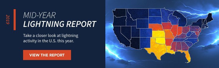
You can see the science behind our Total Lightning Network and flip through total lightning counts, lightning densities, and Dangerous Thunderstorm Alerts data in our 2019 Mid-Year Lightning Report. Access the free report by clicking the link below.

 Best Thunderstorm Alerts
There are a few different thunderstorm alerts to help keep people, organizations, and communities safe from thunderstorms. In this section, we’ll cover the National Weather Service thunderstorm watches and warnings, mobile alerts, horn alerts, and the Storm Prediction Center’s Outlooks.
It’s important to note that lightning can strike over 10 miles away from a storm cell, so we advise all alerts should be set for this threshold or greater.
NWS Severe Thunderstorm Watches and Warnings
The National Weather Service issues Severe Thunderstorm Watches and Warnings to help keep people safe.
According to the NWS, severe thunderstorms are capable of producing hail that is an inch or larger or wind gusts over 58 mph.
Severe Thunderstorm Watch: Severe thunderstorms are possible in and near the watch area. Stay informed and be ready to act if a severe thunderstorm warning is issued. That watch area is typically large, covering numerous counties or even states.
Severe Thunderstorm Warning: Severe weather has been reported by spotters or indicated by radar. Warnings indicate imminent danger to life and property. Take shelter in a substantial building. Evacuate mobile homes that can blow over in high winds. Warnings typically encompass much smaller areas (size of city or small town) that may be impacted by large hail or damaging wind identified by a NWS forecaster or by a trained spotter/law enforcement who is watching the storm.
Mobile Alerts
Mobile alerts for thunderstorms are great for people who are on the go. Mobile alerts can come in as text messages or through notifications on a commercial-grade weather application. They should create a notification including a sound and/or vibration.
Thunderstorm mobile alerts are most reliable when they come from a hyperlocal weather network and include details like the direction the storm is moving, wind speeds, rain rates, and all warnings and watches.
One type of weather alert we disseminate through our mobile application is Dangerous Thunderstorm Alerts (DTAs). DTAs use total lightning to detect severe storms and alert people up to 50% faster than any other form of lightning alert.
Horn Alerts
Horn and/or strobe thunderstorm alerts are a great warning method for large, outdoor spaces. These alerts are impossible to ignore and difficult to argue with.
Communities, recreation facilities, schools, airports, and amusement parks and just some of the organizations that benefit from thunderstorm horns. Our Outdoor Alerting System accesses our Total Lightning Network in order to send out reliable thunderstorm alerts around the world.
Thunderstorm Risk Categories

Another good way to prepare for thunderstorms is with the Storm Prediction Center’s Convective Outlooks. The Storm Prediction Center classifies storms into several risk categories to provide timely and accurate forecasts and watches for severe thunderstorms and tornadoes over the continental United States.
They do this through Day 1, Day 2, and Day 3 Convective Outlooks. These outlooks include listings of severe thunderstorm risk areas, concise summary of threat type(s) and timing, and scientific and technical discussion for sophisticated users.
There are technically six risk levels ranging from 0 (no severe thunderstorms expected) to 5 (widespread severe storms expected). You can review this risk levels below:
Thunderstorms Risk
This first risk category is represented by light green and means that there are general or no-severe thunderstorms. There shouldn’t be any severe thunderstorms, but thunderstorms are still possible.
Marginal Risk
The second risk category is represented by dark green and is considered a level one risk. When this risk level is active for your area it means isolated severe thunderstorms are possible.
These storms are most likely limited in duration, coverage, and intensity, but it’s still a good idea to be alert.
Slight Risk
A slight risk is the third level of risk, represented by yellow. While it sounds tame, it means scattered severe thunderstorms are possible. They’re only possible because an organized system is forecast, but the level of storm severity within the system is varied.
These storms will most likely be short-lived, not widespread, isolated, and intense. Stay alert and know where your nearest shelter is.
Enhanced Risk
Enhanced risk is represented by orange and means that an area of greater severe storm coverage with varying levels of intensity is forecast. With this risk category there is potential for tornadoes, frequent lightning, damaging winds between 58-70 mph, and hail with a diameter between 1-2 inches.
These storms can cause fatalities. Please take them seriously.
Moderate Risk
Moderate risk doesn’t sound so scary, but these storms can do a lot of damage. Represented by red, this category’s storms have a high likelihood for tornadoes, frequent lightning, damaging winds in excess of 70 mph, and large hail in excess of 2 inches in diameter.
This category is active only when government forecasters believe widespread severe storms that are intense and long-lived are likely.
High Risk
The final risk category the Storm Prediction Center uses is high risk. High risk forecasts are quite rare. On average, the Storm Prediction Center only issues them once or twice a year.
Typically, forecasters issue high risk areas when they expect particularly strong and widespread severe storms or tornado outbreaks. There is a strong likelihood of strong and/or long-lasting tornadoes.
These storms also contain frequent lightning, damaging and long-lasting winds in excess of 80 mph, and hail in excess of 2 inches. There is also a strong likelihood of structural damage.
Additional Resources

Still have questions about thunderstorms? Let us know by reaching out to us on Twitter and our meteorologists will answer them as soon as possible.
My #thunderstorm question is: Share on X