Fria Hit By Strong Storms

  • Oct 14, 2013

14 October 2013, 18:30: Late this afternoon the Guinea Meteorological Service was able to issue a Dangerous Thunderstorm Alert (DTA) 20 minutes before a strong storm roared into the city. The DTA issuancewas possible due to the Guinea Total Lightning Detection Network. DTAs warn for frequent lightning, very heavy rain, and gusty winds. rain rates exceeded 80 mm/hr.
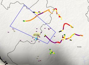
The observation system also recorded extreme rainfall amounts. Amounts exceeded 80 mm/hr at times. Flash flooding is common with rain rates of this magnitude.

The total lightning network allows for the Guinea meteorologists to track strong storms using PulseRad, a simulated radar based on intracloud and cloud-to-ground lightning rates.
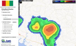
The image shows the strong storm on PulseRad as displayed through visualization software as it was affecting Fria.

The visualization system also shows meteorologists up to the second temperature and rain reports. Temperatures dropped 8 degrees C as the storms approached. Wind gust were recorded around 60 km/hr.
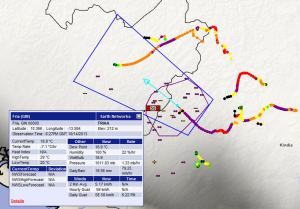
Image shows a strong storm with frequent lightning moving into Fria. A Dangerous Thunderstorm Alert Polygon overs the area to be affected by the storm. The image shows a wind gust value of almost 60 km/hr that occured as the storm moved into the city.