Strong Evening Storms Develop After Warm, Sunny Day
23 Sept 2013, 2000 UTC: After a day that saw copious amounts of sunshine and temperatures rising to some of the highest levels of the month (Daily high temperatures shown below) strong storms developed over the Moyenne Guinea region late this afternoon and this evening.
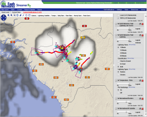
Our total lightning network tracked strong thunderstorms moving out of the northern highlands that were producing very frequent lightning, very heavy rain and gusty winds. The image below shows the storm lightning cells that we tracked as the storms moved west and southwest. Dangerous Thunderstorm Alerts were issued as the storm lightning rates pushed over 40 strikes/min and even over 100 strikes/min.
The graph below shows the history of one of the more impressive storms. Lightning was dominently intracloud which can be detected by the Guinea Total Lightning Sensor Network. and is critical to understanding the intensity and severity of thunderstorms.
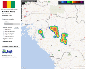
Our PulseRad proxy radar tracked some impressive rainfall rates with these storms. Many areas had 25-50 mm with a couple locations going over 75 mm in just a 2-3 hours this evening.


