Swing States: Americas Most Extreme Temperature Ranges
- Jul 01, 2017

It can be a shock to the system when temperatures fluctuate drastically from day to day. For many places in the U.S., though, this is the norm. Some states experience a more gradual shift from summer to winter. These states have some of the most disparate temperature ranges you will find.
Montana
The first state is Montana: A beautiful state with stunning mountain views, but also the home to some stunning fluctuations in temperature. The coldest temperature that has ever been recorded in the state is -70 degrees, and the most severe fluctuation in 24 hours was a shift from -54 degrees to 49 degrees.
Wyoming
Next is Wyoming. Wyoming’s elevation contributes to a climate that is generally cool, and it is rare to temperatures in the state to exceed 100 degrees. Wintertime, however, is typified by a rapidly fluctuation climate and consistent snow.
North Dakota
There are also extreme temperature swings in North Dakota. Summer in North Dakota promises temperatures in the mid-80s, and in winter, you can expect temperatures as cold as -60 degrees. This extreme range is accompanied by the state’s vulnerability to flooding and extreme winds.
Alaska

The next state on our list of swing states is Alaska. You might imagine Alaska to be perennially freezing, and cold temperatures are a fixture in the state—they can reach -60 degrees. In the summer, though, the climate warms up and residents enjoy sunny days with highs of 80 degrees. Snow occurs year round in some parts of the state.
Oregon
After Alaska is Oregon. Though Oregon is generally known to have a mild climate, the weather seen on its coastline is typically much different than the weather that occurs further inland. The state holds a record high temperature of 117 degrees and a record low temperature of 54 degrees below zero. The former was recorded in Corvallis, which is near the coast, and the latter was recorded in Seneca, which is near the mountains.
California

The next state on our list is California because of its location. The range of temperatures experienced in California is largely due to being on most of the west coast. While the southern portion of the state experiences highs of 70 degrees, the northern portion of California may be enjoying drastically colder temperatures. Temperatures stabilize and get warmer as you travel inland.
Idaho
Idaho is the next state on our list for a few different reasons. Idaho’s weather includes both extreme highs and extreme lows, and there are a number of factors contributing to this. Its geographical location makes the state susceptible to winters with temperatures below zero and summers with temperatures above 100. These are not necessarily separated by season, though. In Idaho, you might see fluctuations between such highs and lows in a matter of days.
Nevada

After Idaho comes Nevada. Nevada’s highest temperature on record is 117 degrees, and its lowest is 50 below zero. With such extreme fluctuations, it isn’t hard to see what the weather is notoriously unpredictable. The state’s desert climate is semi-arid and likely to vary widely throughout different areas.
Minnesota
Next is Minnesota. Between 1895 and 1970, the average temperature in Minnesota rose every decade. Though the increase may seem inconsequential—it was one-tenth of a degree—it precedes the more rapid rise in temperature that the state is experiencing now. This warming is contrasted by the severe winters featuring snow and temperatures that fall well below zero.
Colorado
The last state on our list is Colorado. Colorado’s weather varies greatly throughout the state. The climate in the western part, near the mountains, is prone to very cold winters and cool summers. The eastern plains, however, see abundant rainfall and temperatures in excess of 95 degrees. The topography of the entire state makes it prone to variations in climate that can occur suddenly and within short periods of time.
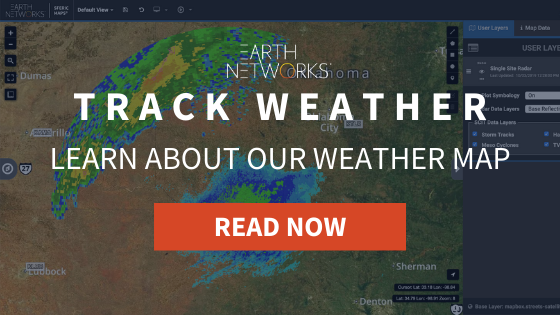
Extreme temperature fluctuations are more than an inconvenience. They can impact your company’s operations many ways. Be sure to use weather tracking tools to be prepared for the day’s weather. You can learn more about our weather tracking tool, Sferic Maps, by downloading the free data sheet below.