3 Reasons Why Sferic Maps is the Best Lightning Data Tool
Lightning data is an important tool for organizations in every industry. From live data that can power alerts to historical data that can help with investigations, lightning data is an affordable and scientific way to improve safety, continuity, efficiency, and all-around operations.
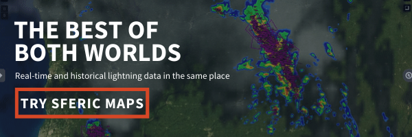
You may not know it, but our weather map is a powerful lightning data tool. Many of our weather layers on Sferic Maps focus on lightning data, lightning alerts, and lightning reports. These are all valuable aspects that take Sferic Maps to the next level.

Why is our weather map also the best lightning data tool? There are three principal reasons:
1. Total Lightning Detection
2. Real-Time Data
3. Historical Lightning Data
Keep reading to learn more about these three aspects that make Sferic Maps the ultimate lightning data tool and how you can start using it at your organization.
1. Total Lightning Detection
Not all lightning data is created equal.

In fact, many lightning data “providers” only detect cloud-to-ground lightning strikes. While cloud-to-ground lightning strikes are indeed the ones that do the most damage, they only account for approximately 20% of all lightning strikes.
Our lightning networks rely on total lightning detection to pinpoint strikes and issue life-saving alerts. The National Oceanic and Atmospheric Administration (NOAA) uses our total lightning network to help warn people of incoming storms. You can learn more about how our network works on the National Severe Storm Laboratory’s website.
Total lightning is the combination of cloud-to-ground and in-cloud lightning strikes. This combination gives the full picture as to what is really going on in the clouds.
Total Lightning Alerts
As we mentioned above, networks that only alert on cloud-to-ground lightning strikes are only alerting on 20% of all lightning activity. Not only that, but these systems are more likely to give off false alarms and miss alarms completely.
Mobile alerts, horns, and strobes that rely on total lightning are the only lightning alerts that cover 100% of lightning strikes. Since in-cloud lightning composes of approximately 80% of all strikes, it is a critical component in alerting. Lightning warnings from total lightning networks have better lead times than those that rely on in-cloud lightning at all.
There are three key ways to receive effective total lightning alerts:
1. Dangerous Thunderstorm Alerts (DTAs)
2. Proximity Alerts
3. Horn & Strobe
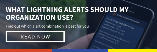
You can learn which alerts are best for your business with our ultimate guide to lightning alerting.
2. Live Lightning Data
The second major benefit to using Sferic Maps as a lightning data tool is that it shows live lightning data in a clean, detailed manner.
In-Cloud vs. Cloud-To-Ground

Our lightning layer shows both in-cloud and cloud-to-ground lightning strikes with an easy-to-read key. Yellow plus signs indicate rare positive cloud-to-ground flashes while the yellow minus signs indicate negative cloud-to-ground flashes. The purple or magenta minus signs indicate in-cloud flashes.
More Lightning Data Per Strike

What if you want to learn more about a strike than whether it was in-cloud or cloud-to-ground? Our weather map has you covered there too. For each strike on the lightning map, you can see:
- Exact Location
- Peak Current
- Time
Access Real-Time Cell Tracks & Lightning Alerts
The most important use for real-time lightning data is hyperlocal alerts. Most people don’t want to dive into lightning data details. They just want to know when lightning could interrupt their operations.
That’s where cell tracks and lightning alerts come into play.
With just the click of your mouse, you can turn on our proprietary DTAs to see where the most dangerous storm cells are heading. The Storm ETA layer also uses live lightning data to give users a heads up on when powerful storms will arrive.

It doesn’t matter if you need lightning data for analyzing strikes as they happen or generating life-saving alerts, both are easy to do on Sferic Maps.
3. Historical Lightning Data
The last major strength of this lightning data tool is that it also includes historical lightning data. Our weather map has a historical lightning archive built in.
What’s the point of having historical lightning data? What use is having lightning data from the past?
Why Historical Lightning Data?
Having historical lightning data is key for finding out what really happened during a storm. In the unfortunate case that dangerous weather damages your equipment or even people at your facility, you can pinpoint exact lightning strikes, their time, and their location.

Historical Lightning Data Use Cases
Let’s take a look at a few use cases.
Use Case #1
Wind turbines at wind farms are especially vulnerable to lightning strikes. Strikes can damage expensive equipment and render it unusable. When a thunderstorm passes through, management can run a historical point to see if anything struck a turbine before they start operations again. That way, they can get to work fixing or replacing equipment before they send crews back up. It saves time, and therefore money.
Use Case #2
Here’s a second use case, which has unfortunately happened before. Let’s say a lightning strike hits a plane while crews are refueling it, gravely injuring a member of that crew. The company can pull historical lightning data to find that exact strike as investigations proceed.
The Comprehensive Lightning Data Tool
Accessing live and historical total lightning data is easier and quicker when you can do it all in the same interface.
Sferic Maps the most comprehensive lightning data tool for organizations like wind farms, airports, and insurance companies.
With the ability to access and visualize both live and historical total lightning data, you can monitor current storms, get live-saving alerts, and pull historical lightning data.
Ready to give Sferic Maps a try? You can start a free trial today.